Zi
Quick Inquiry
Overview

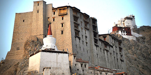
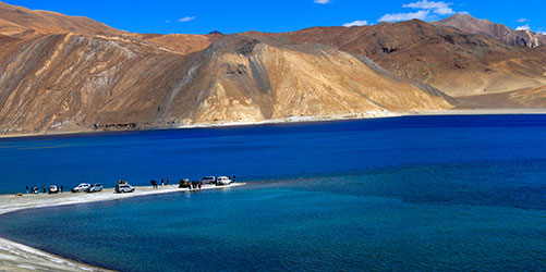
Leh, the ancient capital of ladakh region is perched at an altitude of 3,350m amidst starkly beautiful mountains, which softly combine into an oasis of lush fields.

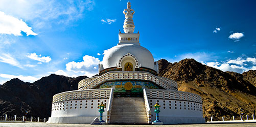
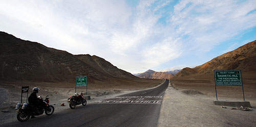
Today Leh has emerged as an important tourist destination providing a usual holiday. It is a perfect place for climbing, trekking, white water rafting and camping. The region is studded with a number of Buddhist monasteries and glorious palaces.

The headquarters of india’s largest district. Ladakh with the smallest population was first opened to tourists in 1974.

  • Leh, for centuries, was an important commercial junction linking central Asia with Kashmir, and kulu valley of Himachal Pradesh with Tibet and China.
  • In this land of lamas there are many monasteries called Gamphas the Buddhist deities are worshipped. The nearest to the town is Shankar Gompha 3km away containing many golden images and a collection of rare pictures. The famous Gomphas, numbering 12 are scattered around the town. Hemis Gompha is the largest of them all 49km from Leh, with several golden images and stupa adorned with most valuable metals. The famous Hemis festival is held in the second half of June or early July every year it features mask dances. It draws crowds of spectators. A legend says that Christ spent some years as a boy here.
History And Culture

This city with rich history has a rich cultural heritage as well. It is also called the land of monasteries. Though Budhhism is a dominant religion in this city there is a sizable population of Muslims as well. People from other communities’ like Hindus and Christians also live here. There is always a feeling of harmony. As far as language is considered most of the people speak Ladakhi. People here are also fond of their dance and music. Jabro, Shondol, Marriage Dance and Kampa Sumsak are some of the well known traditional dance. So come and experience the rich culture and heritage of place called Leh. 

Areas in Leh

Leh Palace
  • The old town curls up in the shadow of a hill on which are located the lehchen pelkhar, or leh palace, and above the palace, the namgyal tsemo gompa. The nine storey royal palce, an imitabtion of the great potala in lhasa, was built by sengye namgyal when he shifted the capital from basgo to leh in the 17th  century.
  • Timing: 10am to 4pm
Shanti Stupa
  • This white stupa in Changspa is a relatively new addition to Leh, inaugurated by the dalai lama in 1985. One of several such monuments erected by a ja[anise Buddhist ‘peace sect’, the stupa is decorated with panels depicting the buddha’s life. The architecture is modern and lacks the character of the other ladakhi monuments, but the site offers great views of leh.
Magnetic Hill
  • 26km west of leh towards basgo, patthar sahib is asmall dip in the road beside a signboard announcing ‘magnetic hill’. Also known as Gravity hill, these are places where the layout of the surrounding lan produces an optical illusion which makes a slight downhill slope look like an uphill slope. Thus a car left out of gear will magically appear to be rolling uphill! From here, continue 3km ahead to gape at the confluence where the Indus river receives its Zanskar tributary, just short of Nimmu. 
Nubra Valley
  • The nubra river runs through desert, but set like jewels on a necklace are the little oases of tirit, sumur, tegar and panamik. Nubra means green named for these fertile, well cultivated oases. The village is also said to have the best climate if ladakh. First up along the nubra road is tiny tirit village, ahead of tirit is lugzhun village where you can pause to take in the confluence of the nubra and shayok.
  • To the north east of leh lies the nubra valley, beyond the formidable khardung la pass. This was the ancient trade route that linked the north Indian plains with the central asian cities of yarkand and khotan, a trade route which existed until 1949, when the Chinese firmly closed the border. More’s the pity, as people of nubra, once proud and independent traders, are dependent on handouts from the Indian army, and on tourism.
Pangong TSO (Lake)
  • 160km southeast of leh the largest salt water lake in asia lies in eastern ladakh, at 14,764ft on the border of Indian and Tibet, one third of it falling in india and two third in Tibet. In 17th  century,  deldan namgyal (the king of ladakh), had supported Bhutan in the Tibet Bhutan war. The peeved Tibetans responded with a military attack on ladakh. Deldan, unable to fight them, sought assistance from the mughals, who agreed to intervene on the condition that the king convert to islam. The Tibetans and ladakhis were equally horrified by theis prospect and reached an agreement in 1684. Deldan namgyal gave away portions of his territory to the regent of Tibet and with this they drew the new border through pangong tso. Even today, a third of the lake lies in india and two thirds in Tibet, china.
  • From the shore, pangong tso seemed an unending expanse of blue. It is 134km long and 5km wide at its widest point and 328ft deep. Geologists believe that the very brackish lake was once a freshwater one. Over time minerals were deposited through glacial action and snowfall, rendering the lake salty and its entire freshwater species extinct. In 1863, british explorer godwin Austin noted in his journal that the lake was only slightly salty, showed no signs ofaquatic life but that the shores were srewn with shells of fresh water species. Today, as you walk along the lake, consider yourself very lucky if you find such a fossil-shell.
© 2017 TRAVEL POINT ALL RIGHTS RESERVED
DESIGN BY WEBPLUS